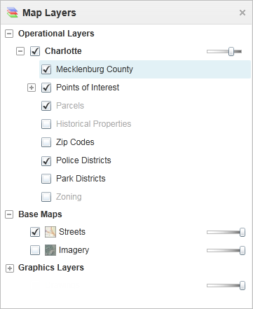
Layers contain all the data in a web map, so knowing how layers function is essential. For a description of the Map Layers (Layer List) go to Map Layers/Layer List.
Map Layers in the information panel
To change the visibility of layers on the map:
To turn a layer on  or off
  , click the checkbox in front of that layer in the Map Layers.
Layers with text that is pale gray are not visible at the current scale.
To zoom directly to where a layer is visible, click that layer in the list, and then click Zoom To Visible Scale.
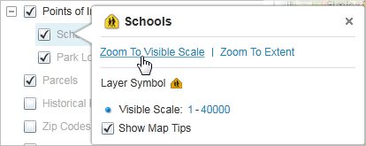
Click Zoom To Visible Scale in the Layer Actions menu
To zoom to an extent that is just large enough to include all the layer's features, click the layer to open the Layer Actions menu, and then click Zoom to Extent.
This is different from the Zoom to Full Extent tool in the Getting Around tab of the toolbar, which zooms out as far as possible.
To make a layer transparent, drag the transparency slider to the left.
![]()
The Charlotte county border layer changed to 65% transparency
To quickly filter the list of layers to show only the one you want to see, start to type the name into the Filter box.
The Map Layers list updates as you type to show only the layers that match your filter word.
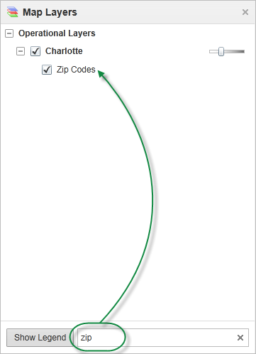
Use the Filter box to list only layers you want to see
Filtering the layers in the Map Layers panel does not affect the visibility of the layers on the map, but it does make it easier to find a particular layer or reduce the number of layers if you are working with a long list of layers.
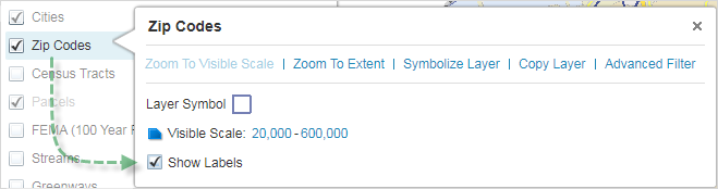
To toggle the labels on a dynamic map layer on or off, right-click the layer and select or deselect Show Labels.
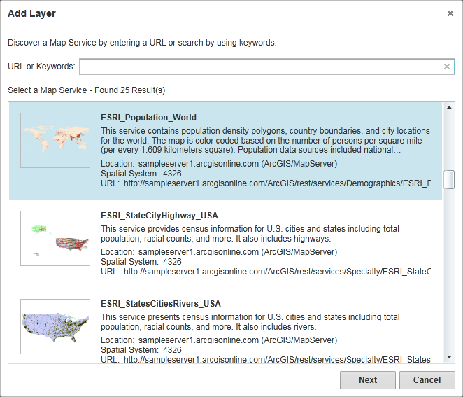
It is possible to add layers to your map from other online map services, for example, the ESRI World Population map service that contains population density information for cities around the world. You can add a map service using a URL or search for one using keywords.
In most cases, you cannot add a layer that has a coordinate system that is not compatible with the existing map. In some cases, you can add a dynamic map service with a different coordinate system and it will work because the ArcGIS Server is re-projecting the map on-the-fly. However, the map is likely to be slow to draw.
To add a map layer:
On the Maps and Data Sources tab of the toolbar, click the Add Map Layer tool.

Add Map Layer tool.
In the Add Layer dialog box, either paste in the URL of the map service into the URL or Keywords box, or select from the list of map services available.
Select a layer from the Add Layer dialog box
Click Next, and then in the Layer Alias box, type the description you want to use for this layer in your Map Layers list.
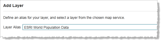
Type in a name for the layer to display in Map Layers
When the message confirms that the layer has been added to the map, click Add Layer and close the window.
The new layers appear in the Map Layers and can be viewed in the map.
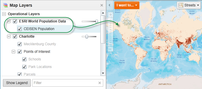
Layers added to the Map Layers
You can change the order that map services and layers draw on the map, for example, if you added a map service layer but want it to appear under an older layer rather than on top.
To change the drawing order of a map service or a layer:
On the Maps and Data Sources tab of the toolbar, click the Layer Drawing Order tool.

Layer Drawing Order tool
To change the order of a map service, drag it into a new position.
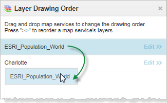
Drag a map service to change the drawing order
 beside the map service that contains the layer.
Drag the layer to a new position
When you drag a layer, the cursor keeps a label containing the name of the layer you are dragging, and an orange line appears to show you where the layer will go when you release the mouse.
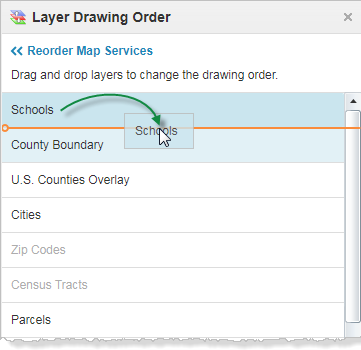
Release the mouse button.
If you have spent time adding and defining a set of layers that you want to use again, you can Save and Open Projects. When you save a project, all the map layers are saved including any markup, measurements, or bookmarks you have added to the map.
See also...