Click the Analysis tab of the toolbar to find the identify tools.
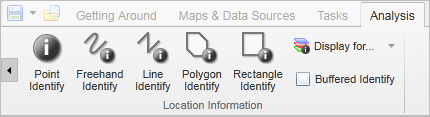
Identify tools on the Analysis tab of the toolbar
Click Point Identify, and then click any point on the map.
Any features found at that point on the map are included in the identify process.
Click Freehand Identify, and then draw in any direction on the map over any features that you want to include in the identify process.
When you lift your finger from the mouse, the identify process begins. All the features that intersect with the line are included in the identify process.
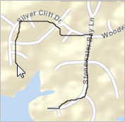
Draw a freehand line to identify features
Click Line Identify, and then drag across the map to draw a line.
To continue the line but change direction, click the map and then drag in the new direction. To end the line, double-click. All the features that intersect with the line are included in the identify process.
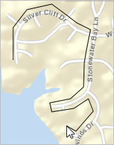
Draw a line to identify features under it.
Click Polygon Identify, and then drag across the map to start a polygon.
To change direction, click and drag in a new direction. A black shading appears under your cursor to indicate that the polygon is filling in the space of the area.
Continue to click until the shading has covered the area you want to include in the identify process. Double-click to end the polygon. You do not have to complete the shape. As long as the shading covers the area, you can double-click and the line will be completed automatically. All the features beneath the shaded area are included in the identify process.
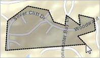
Draw a polygon to identify features under the shaded area
Click Rectangle Identify, and then click on one corner of the area you want to define.
Drag a square away from the corner you clicked. A black shaded square appears under the cursor. When your area is enclosed in the square, lift your finger from the mouse. All the features covered by the rectangle are included in the identify process.
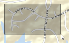
Draw a rectangle to identify features under the shaded area
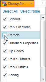
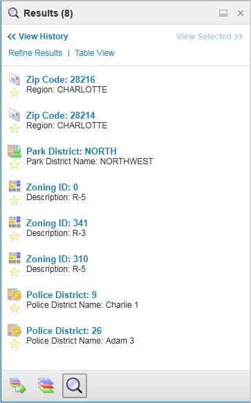
When features are listed in the Results List, they are grouped by layer:
Identify results listed by layer